DNR map.
Weather patterns are shifting and the quality of Iowa’s air is again taking a dip.
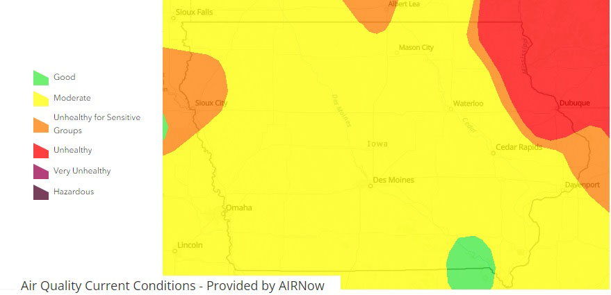
The Iowa DNR’s Air Quality Bureau has an online map that shows real-time updates as the smoke from those Canadian wildfires streams back over our state. Iowa’s Air Quality Index shows a chunk of northeast Iowa in the “unhealthy” category. The red zone covers parts or all of several counties, including: Winneshiek, Allamakee, Clayton, Delaware, Dubuque, Jones and Jackson.
It’s recommended residents in the area limit strenuous outdoor activities. Most of the state has “moderate” air quality today, though there are patches in north-central and northwest Iowa that are “unhealthy for sensitive groups,” and there’s one patch of air in “good” condition in southeast Iowa.