Much of Iowa is seeing above-normal temperatures for the first week of February, a radical change...
After 70-degree swing from snowy January, look for warmth ahead
read more
Much of Iowa is seeing above-normal temperatures for the first week of February, a radical change...

While many Iowans are enjoying temperatures well above normal in the 40s and 50s, it was just two...
With the freeze-thaw cycle underway, many Iowa roads are being pockmarked by potholes and avoiding...
Iowa roads that were knee-deep in snow and ice just a matter of days ago are quickly becoming...

The annual Okoboji Winter Games are underway in northwest Iowa. Great Lakes Area Chamber of...
A state expert says the snow this month is going to be a help after months of drought. Iowa DNR...

Forecasters say tomorrow morning's commute could be a mess, as a mix or rain, snow and ice is...

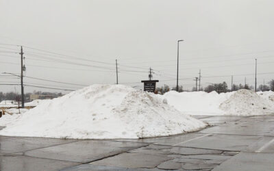
If you thought clearing off your driveway and sidewalk after the recent blizzard was tough,...

Forecasters say high temperatures today and tomorrow won't get out of the single digits, and wind...

The manager of the DeSoto National Wildlife Refuge in western Iowa reports not as many birds flew...

The Marshall County Sheriff's Department and other first responders helped a woman give birth...

The spokesman for the state's largest utility company says the heavy winds that accompanied the...

Another winter storm is headed for Iowa but forecasters say it shouldn't bring anywhere near as...

Work continues to remove the cars and trucks that hit the ditches in eastern Iowa following last...

You may be eligible for some help with your heating bill. The federally funded Low-Income Home...

We are starting to slowly move out of the subzero temperature pattern the state has been in the...

Forecasters say Iowa may not see temperatures above 32-degrees again for at least another week,...

The acts are being announced for the popular Hinterland Music Festival that's held in the...

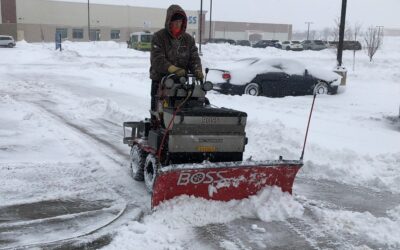
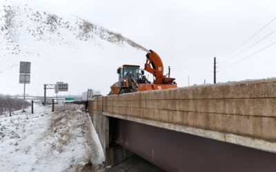
Some state road crews are getting a breather after the double whammy of storms that kept them busy...
Snow is not in Iowa's forecast -- until late Wednesday and Thursday. Meteorologist Allan Curtis at...

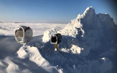
Much of Iowa is under a Blizzard Warning and the Iowa State Patrol is posting photos taken this...

This week will end much as it started, with a whopper snowstorm. Forecasters say a Winter Storm...

The wicked cold of winter has moved into the region, and it's prompting an increase in flows...

City, county and state road crews have been on-the-job since late Monday, working with snow plows,...

For many Iowans, this will be the first snow they've shoveled since last winter, and the experts...

Iowa's largest electric utility is reporting scattered power outages as the first statewide...

After three consecutive winters dominated by the La Niña weather pattern, we're now a few weeks...

Iowa's fleet of snow plows and trucks is ready for the first big statewide blast of winter. Craig...

Forecasters say the approaching winter storm threatens to bring heavy snowfall to much of Iowa,...
The final tallies are in, and state climatologist Justin Glisan says 2023 is going down as one of...